
EM 1110-2-1100 (Part V)
31 Jul 2003
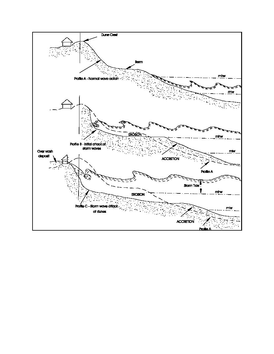
Figure V-4-1. Schematic diagram of storm wave attack on a beach, dune, and upland structures
elevations on the beach. These were formed during previous storms and are either remnant scarps left behind
as a result of erosion of the lower berm or as a result of deposits left from wave uprush during higher-than-
normal water levels associated with storms. Beaches that are in a severely eroded condition might have little
or no berm at high tide.
(b) A nourishment project usually involves widening the beach (i.e., translating it seaward) to create a
wider sand buffer for dissipating storm wave energy. The amount of additional width is determined based
on the desired level of storm protection, the persistent long-term erosional trends that characterize the project
area, and the target renourishment interval. The design berm width is determined through an iterative process
that evaluates economic benefits as a function of width. The elevation of the constructed berm is usually set
at the same elevation as the natural berm, or slightly higher. If the berm is constructed at an elevation lower
than the natural berm crest, a ridge will form along the seaward edge of the fill. Wave uprush during higher
water will overtop the ridge, causing temporary undesirable ponding on the beach until the berm elevation
V-4-2
Beach Fill Design

 Previous Page
