EM 1110-2-1100 (Part III)
30 Apr 02
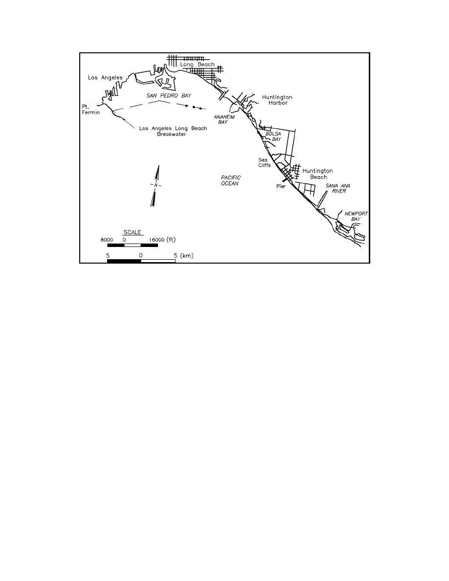
Figure III-2-47.
Bolsa Chica, California, study area (Gravens 1990a)
(c) The modeled reach from Anaheim Bay to the Santa Ana River forms a littoral cell, including a
complete barrier to littoral transport at Anaheim Bay, and a submarine canyon offshore of Newport Beach
(Figure III-2-47). Coastal structures and features of importance within the model reach include the east
Anaheim jetty, the sea cliffs at Huntington Beach, the Huntington Beach pier, and the north jetty at the mouth
of the Santa Ana River. Each of these features influences the evolution of adjacent shoreline and was
represented in the shoreline change model. The sea cliffs at Huntington Beach serve to pin the shoreline
between the cliffs and Anaheim Bay to the northwest and the Santa Ana River to the southeast. The
Huntington Pier and the east Anaheim Bay jetty modify the local breaking wave pattern and produce a local
shoreline signature unique to these structures. Beaches between Anaheim Bay and the Santa Ana River have
accreted an average of 1.3 m/year (4.4 ft/year) between 1934 and 1983.
(d) Ten shoreline position data sets dating from 1878 and 1983 were analyzed to determine historical
and representative shoreline change trends. As a result of this analysis, the 1963, 1970, and 1983 shorelines
were determined to be representative, and were summarized at 61-m (200-ft) intervals for model calibration
(1963 to 1970) and verification (1970 to 1983).
(e) For the comprehensive shoreline response study, hindcast wave estimates at stations located near
the lateral boundaries of the modeled shoreline reach were transformed from the hindcast stations to the
offshore boundary of the GENESIS grid using the linear wave propagation model RCPWAVE (Regional
Coastal Processes Wave Model; Ebersole 1985; Ebersole, Cialone, and Prater 1986) (Figure III-2-48). Use
of two hindcast stations allowed systematic variations in the incident waves (alongshore wave height and
angle) to be accounted for in RCPWAVE and ultimately in GENESIS.
Longshore Sediment Transport
III-2-83


 Previous Page
